2009年04月 アーカイブ
- 2009年04月27日 ヨセミテ 4月26日
- 2009年04月22日 Mariposa Grove Road開通
- 2009年04月20日 4月19日 : Yosemite Falls
- 2009年04月18日 GP Rd. 開通予定日
- 2009年04月17日 Housekeeping Campが営業開始
- 2009年04月16日 4月24日 Glacier Point Rd. 開通予定?
- 2009年04月15日 Professional Paper 160
- 2009年04月14日 ヨセミテ渓谷における岩崩れの可能性
- 2009年04月13日 キャンプ場情報
- 2009年04月12日 4月11日 ヨセミテ
- 2009年04月09日 Half Domeでの崖崩れ
- 2009年04月08日 Mist Trail
- 2009年04月08日 ミストトレイル開通
- 2009年04月05日 ヨセミテ 4月4日
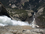
2009年04月27日
ヨセミテ 4月26日
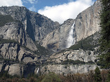
ヨセミテ フォール。
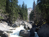
Footbridgeより望むVernal Fall(12時半)。 Merced Riverの水量はかなり増えています。
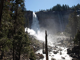
Vernal Fall(昼すぎ): MISTでかなり濡れます。ハイカーで賑わっていました。
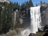
Nevada Fall@noon:やや逆光気味です。ここもかなり水しぶきが上がっていました。
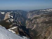
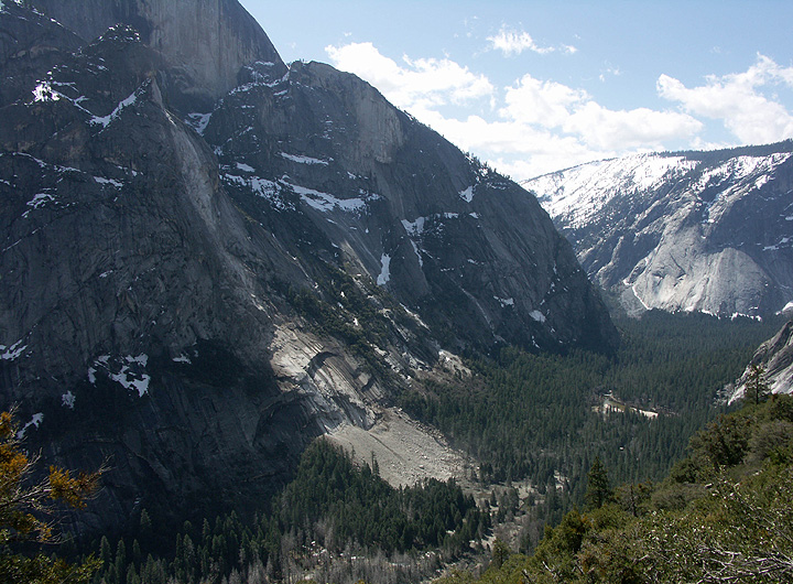
ヨセミテ渓谷展望。
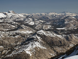
Olmsted Point、Tenaya Lake方面。3週前に比べ、かなり雪が少なくなっています。
今週後半、Tioga Rd.の除雪はかなりの確率でOlmsted Pointの達すると思われます。
2009年04月22日
Mariposa Grove Road開通
Mariposa Grove Roadが21日から開通しています。
ワワナからのシャトルバスの運行はまだのようです。
---
The Mariposa Grove Road is now open to public motor vehicle traffic. There is a 7 ton weight limit on the road until further notice. Shuttle bus service from Wawona to Mariposa Grove is not yet in service. (M. Dowdle - 4/21/09)
2009年04月20日
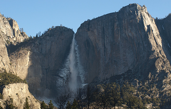
4月19日 : Yosemite Falls
今日のYosemite Falls。トレイル上に雪は全くなく、かなりの人がチャレンジしていました。
ヨセミテフォールトレイルを三分の一程上り、突然滝が見える付近。
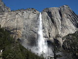
約半分ほどのところ。此処から先滝は見えなくなります。
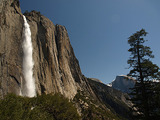
滝の落ち口の展望台から。
Eagle Towerから見下ろす滝とトレイル上部(左側のスイッチバック)。
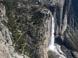
撮影時間は下から上の順。
2009年04月18日
GP Rd. 開通予定日
やはり来週24日に開通の予定です。
だとすると、過去14年で最も早い開通日になります。
The Glacier Point Road tentatively may open on Friday, April 24, conditions permitting.
The Mariposa Grove Road tentatively may open on Friday, April 17, conditions permitting.
2009年04月17日
Housekeeping Campが営業開始
ハウスキーピングキャンプが今週末からシーズンの営業を開始します。
---
Housekeeping Camp Opens Friday, April 17, 2009. Due to construction activities on Southside Drive, access to Housekeeping Camp is available by following the orange detour signs directing visitors to Curry Village. HousekeepingCamp provides rustic overnight accommodations, a store, and public laundry facilities. For additional information about this and other visitor services in Yosemite Valley, go to www.YosemitePark.com. (V. McMichael - 4/16/09)
2009年04月16日
4月24日 Glacier Point Rd. 開通予定?
すでにッ除雪は終り、道路を広げる仕事に入っているようです。来週は道路のパッチワークを終え、24日には開通のようですが...
Glacier Point Road
Crew is continuing to widen the road and clear the parking lot. As of now the main spot of concern regarding road width is from summit meadow to Badger. That area will be widened this morning and the dozers will be able to be hauled starting today. Next week we will be patching and repairing the roadway in various locations.The fuel truck is scheduled to be delivered to the 140 /120 junction tomorrow. Tentative opening date will be April 24, 2009 pending any additional storms or safety concerns.
2009年04月15日
Professional Paper 160
いつの間にかNPSのWebに、Matthesの論文”Professional Paper 160”がUPされていました。
とりあえずこのページは必見です。ヨセミテ問題(『渓谷がいかにして生成されたか』)の経緯に興味のある方には、イントロを読まれることをお勧め。プレートテクトニクス理論も存在しない1900年代初期の研究成果をまとめたものですが、今でもよく引用されるヨセミテ関連の重要な文献です。数多くの写真(白黒)とさし絵、そして氷河に覆われていた頃のヨセミテの地図(予想)が掲載されていますので、スキャンの価値はあります。
2009年04月14日
ヨセミテ渓谷における岩崩れの可能性
1999年、USGSのWieczorekらにより"Rock-fall Potential in the Yosemite Valley, California"という報告書が書かれています。この中にはかなり精密な地図(サイズは7MB強)が掲載されており、当時(1999年)に至る渓谷での岩崩れの跡、被害が及ぶ可能性のある地帯などが記されています。今回のAhwiyah Pointは、過去に岩崩れがなかった所のようです。
有名な2003年冬のCurry Village裏の岩崩れの報告書はこちら。絵と写真だけでも必見。
タイトル”Rock-fall”は、”落石”ではなんとなくイメージがわかないので”岩崩れ”にしました。
2009年04月13日
キャンプ場情報
Hodgdon Meadowの予約の開始、WawonaのB,Cループのサイトがオープンしています。
---
Campground Updates - As of Friday, April 10, the Hodgdon Meadow Campground is on reservations, and the B and C loops of the Wawona Campground are open (Wawona will remain open on first-come, first-serve basis until the campground paving project is complete--specific dates for the project are unknown at this time. As soon as the project is completed, the campground will be put back on the reservation system). (M. Carter - 4/10/09)
2009年04月12日
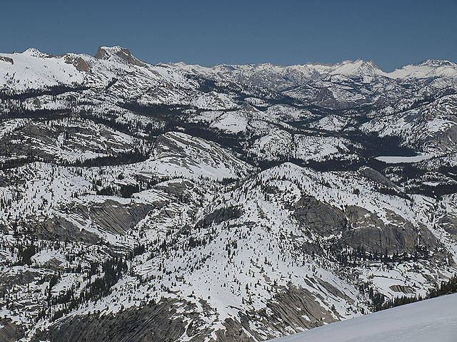
4月11日 ヨセミテ
Tioga Roadの様子をみてきました。
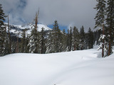
May Lakeへの分岐点から0.5マイルほど南(感覚的には東)に進んだ付近。左に見えているのはMt. Hoffmann。
積雪は1?2メートル。
Olmsted Pt.から見たClouds RestとHalf Dome。先日の嵐により、かなりの降雪がありました。
同じくOlmsted Pt.から見たTenaya Lake方面。意外にも左側斜面(雪崩の危険地帯)の雪は少なめ。
やはり、Tioga Rdの開通は5月末と思われます。
2009年04月09日
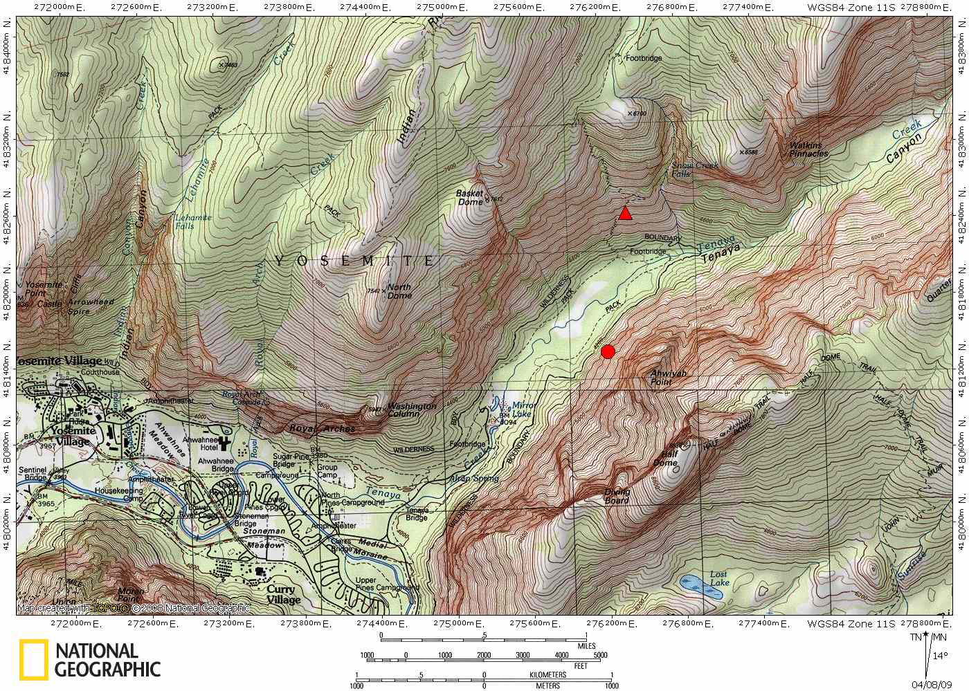
Half Domeでの崖崩れ
3月28日、Half Domeで大規模な岩崩れがあったもようです。
以下の写真はNPSよりコピー、縮小したものです。Mirror Lake Loop Trailの南側は通行禁止となっています。
(Mirror Lakeまでの一般路は問題なし)。
詳しくはこのリンクで。
大まかですが、地図の○が崩落地点、△は撮影した地点(Snow Creek Trail)。
2009年04月08日
Mist Trail
先日の続きの写真です。
朝のYosemite Falls(上段部)。夜に水しぶきが凍って岩に張り付きます。滝に日があたり始めると、塊が落下し渓谷に大きな音を響かせます。
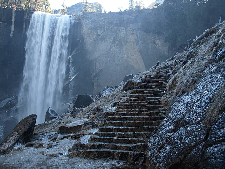
開通したと言うものの、Vernal滝沿いのMist Trailはがちがちに凍っていました。滝の傍の日陰の部分は、午後遅くになっても融けていませんでした。かなり危険ですので、行かれる方ははご注意。そのせいか、Venal Fallの落ち口にはあまり人はいませんでした。
今日からまた冷えはじめ、雪も降り始めるようです。今週末は雪景色のValleyになるかも。
ミストトレイル開通
ミストトレイル(ハッピーアイル〜ネヴァダ滝)が今シーズン開通しています。
JMTの「アイスカット」部分はまだクローズのようです。
The Mist Trail is now open for the season. The "Ice Cut", Clark Point to Nevada Fall, on the John Muir Trail is still closed due to hazardous ice build up. (K. Watson - 4/3/09)
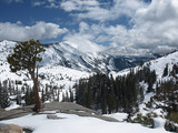
2009年04月05日
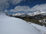
ヨセミテ 4月4日
本日のヨセミテの写真です。積雪は、特に少ないようにはみえませんでした。
根拠のない予想ですが、Tioga Passが開くのは5月の後半と思われます。
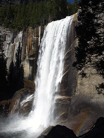
Vernal Fall
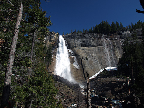
Navada Fall
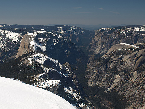
左からHalf Dome、Sentinel Dome、Valley Floor、El Capitan、そしてNorth Dome。
Olmsted Pt(写真中央の白い斜面付近)とTenaya Lake(右側の白く平らな部分)。Olmsted Pt.付近のTioga Roadがかすかに見えています。肉眼では斜面に雪崩の跡が確認できました。左側の山はTuolumne Peak(その左側にあるMt. Hofmannは写っていません)。