2006年09月25日
USGSプレゼンテーション:Clarence King
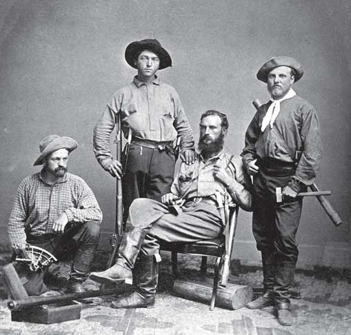
写真:The 1864 field party of the California Geological Survey (Charles Hoffmann absent). From left to right: James T. Gardner, Richard D. Cotter, William H. Brewer, and Clarence King. Gardner is holding a sextant used for mapping and astronomical location; Cotter is armed with musket, dagger, and pistol; both Brewer and King have mercury barometers - used to measure altitudes - slung on their shoulders; and King holds a geologist's hammer. (U.S. Geological Survey Library)
あまりヨセミテは登場しませんが、USGSの面白いプレゼンテーションビデオを見つけました。
タイトルは”Mapping the American West: Clarence King and the 40th Parallel Survey”で、スピーカーはJames G. Moore氏(Geologist)です。 時間は約50分。1863年の夏、California Geological Survey(Whitney隊)のHoffmannとBrewerらはヨセミテでの測量を行いました。その時Mt. Hoffmann、Danaへ登頂しますが、Mt. Lyellへは不成功に終わります。その後Mono Lake、Sonora Pass、Carson Pass、Lake Tahoeを越えてSacramentoに戻ったBrewerは、San Franciscoへ向かう蒸気船に乗船し、そこでYale大学を出て間もないClarence KingとJames Gardinerに出会います。
氏の話はそこから始まり、一行のLassen Peakを始めとするカリフォルニア北部の探査(1863)、1864年の南シエラ(現在のKings、Sequoia NP、Inyo NF)と制定されたばかりのヨセミテ渓谷州立公園での測量、1867年からKing自らが率いたアメリカ西部・北緯40度付近での測量(the 40th Parallel Survey)について触れられます。そしてMt. ShastaやWhitney登山の逸話のあと、USGSの設立(Kingは初代所長)で話が結ばれています。
[註]話は変わりますが、文献から推察できるように、MuirはWhitney隊の記録をかなり意識していました。Tuolumne渓谷、Kings渓谷、Middle Fork Kings River、Mt. Ritter、Mt. Tyndall、Mt. Whitney、Mt. Shasta、ヨセミテの氷河(跡)、セコイアの群生などと、隊が調査・指摘・登山しようとした場所をことごとく追いかけています(Tyndallは間違った山を登りましたが)。
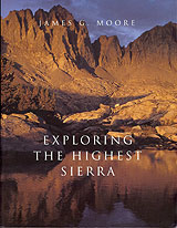
このビデオに関連した氏の著作は:”Exploring The Highest Sierra”(2000年、Stanford University Press)と”King of the 40th Parallel”(2006年、Stanford University Press)があります。前者は、南シエラの探検と地質学の2部構成といえます。総400+ページ。昔の地図、写真、絵などが多様され、見るだけでも楽しめます(後編は岩、造山などの話になり、少々退屈します)。